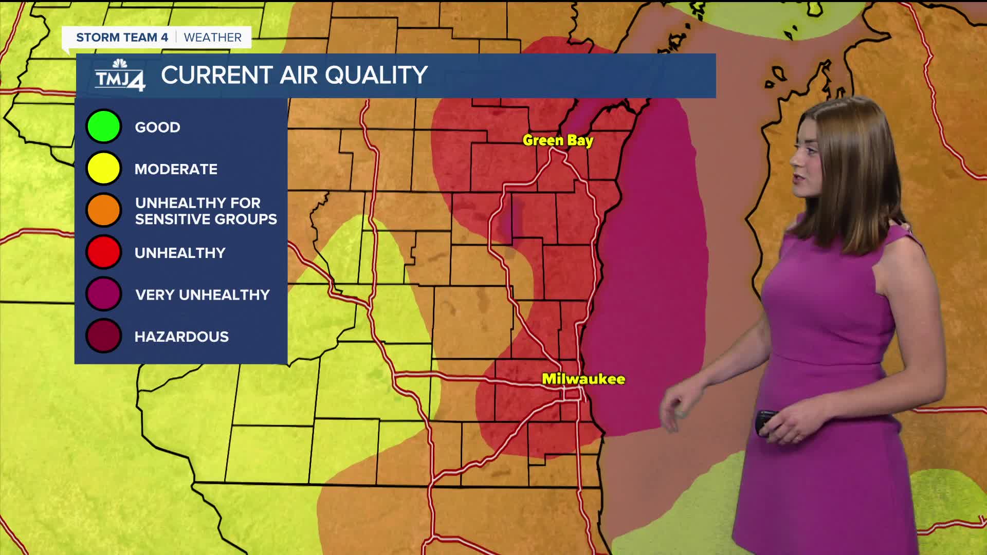


It's another day in the red. Our air quality is unhealthy for everyone. If you have spent time outside this weekend, I'm sure you've felt the smoke in your eyes or your throat.
As the Canadian wildfire smoke lingers, we can expect air quality in the red and orange categories into Monday. Besides the smoke, it has been a great weekend!
High temperatures were near 80 degrees. Low dew points lead to comfortable air.
As we look into Monday, you can expect highs in the low 80s with sun and smoke.
Our next chance for rain holds off until next Wednesday. This is also when you can expect some humidity to roll back in.
WATCH: Southeastern Wisconsin weather: Smoky skies continue into the work week
TONIGHT: Partly Cloudy with Some Smoke
Low: 60 Lake 57 Inland
Wind: NE 5 mph
MONDAY: Mostly Sunny, smoke lingers
High: 81
TUESDAY: Partly Cloudy and Some humidity
High: 82
WEDNESDAY: Sunny, chance for storms, humid
High: 84
THURSDAY: Sunny, chance for storms, humid
High: 88
It’s about time to watch on your time. Stream local news and weather 24/7 by searching for “TMJ4” on your device.
Available for download on Roku, Apple TV, Amazon Fire TV, and more.
