

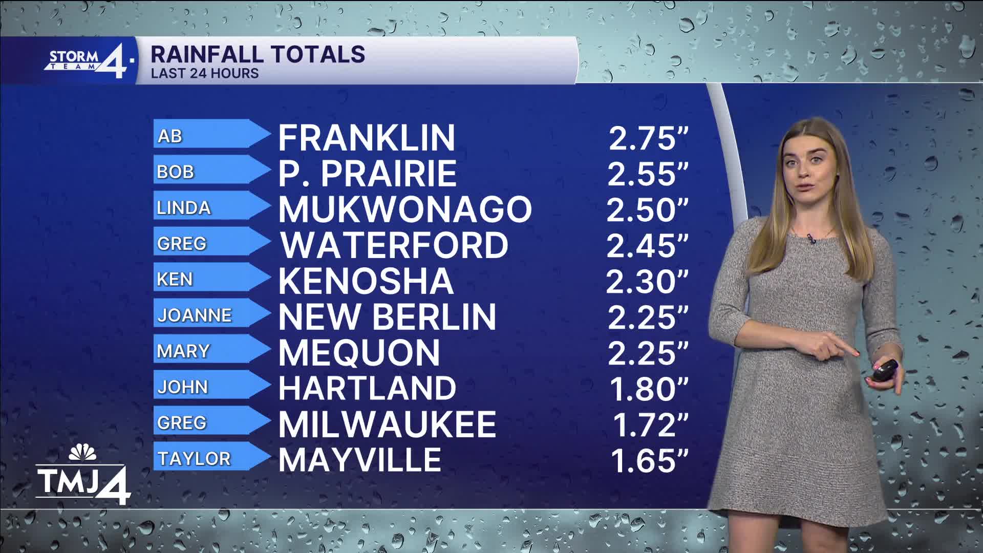


We have seen inches of rain since Friday night.
Rounds of showers and storms continue later tonight. There is still uncertainty in total rainfall amounts, but another 1-3" is not out of the question, especially south of interstate 94. The flood watch is in effect for our southern counties until 7A Sunday.
Severe weather is unlikely, with the only impact expected to be heavy rain. Never drive through flooded roadways.
The heaviest of rain looks to clear out Sunday morning and leave us with mostly cloudy skies into the afternoon. Our highs will make it to the mid 60s on Sunday. It will be a bit breezy, with gusts up to 30 mph at times.
The breezy conditions continues through Monday, with chilly northeast winds our highs are only in the low 60s.
Most of next week will be fairly dry with the fall-like air continuing all week.
HERE'S YOUR LATEST STORM TEAM WEATHER FORECAST FOR MILWAUKEE
AND SOUTHEASTERN WISCONSIN BY METEOROLOGIST LAUREN LARSEN
***FLOOD WATCH FOR JEFFERSON, WAUKESHA, MILWAUKEE, ROCK, WALWORTH, RACINE, AND KENOSHA COUNTIES UNTIL 7A SUNDAY***
TONIGHT: Rain showers & thunderstorms
Low: 60
Wind: NE 5-10 mph
SUNDAY: Showers Clear
High: 66
Wind: NE 10-20 mph
MONDAY: Slight Shower Chance; Mostly Cloudy & Breezy
High: 62
Wind: NE 10-20 mph
TUESDAY: Slight Shower Chance; Partly Cloudy
High: 61
WEDNESDAY: Partly Cloudy
High: 63
THURSDAY: Partly Cloudy
High: 65
It’s about time to watch on your time. Stream local news and weather 24/7 by searching for “TMJ4” on your device.
Available for download on Roku, Apple TV, Amazon Fire TV, and more.
