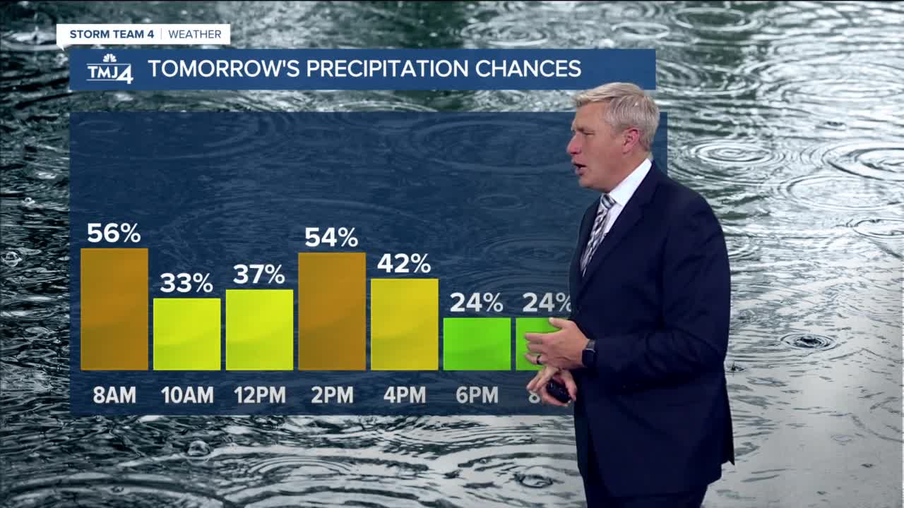


We started the day with a lot of sun and a rapid warm up into the 70s, then clouds moved in with a few areas of sprinkles and light rain, mainly north of Milwaukee. We will stay mostly cloudy this evening with temps near 70, and it looks like we stay dry until after midnight. Storms are developing this evening in Western Wisconsin and will weaken as they move east, but a scattered t'shower is possible, especially north of Milwaukee overnight. Friday morning is in the mid to upper 60s with a few showers, and the high is 74 around noon. Scattered showers and t'showers are likely throughout the day along a cold front, a temps will drop into the 60s in the afternoon.
Saturday is a dreary, breezy, rainy and chilly day with highs in the 50s and off and on rain showers throughout the day. Most of us should see about a half inch of rain, while isolated areas could see 1". The sun returns on Sunday with highs only in the 50s. Monday is sunny and near 60, and then scattered showers are in the forecast for Tuesday, Wednesday, and Thursday with highs in the low 60s.
TONIGHT: Mostly cloudy and mild with scattered t'showers
Low: 66
Wind: SW 10-15 mph
FRIDAY: Mostly cloudy with showers and t'showers likely
High: 74 and falling
Wind: SW/NW 10-20 mph
SATURDAY: Cloudy, breezy and cool with showers
High: 52 Lakefront...60 Inland
Wind: NE 10-20 mph
SUNDAY: Mostly sunny and cool
High: 55 Lakefront...61 Inland
Wind: NW 5-15 mph
MONDAY: Mostly sunny and pleasant
High: 56 Lakefront...65 Inland
Wind: NE 5-15 mph
TUESDAY: Partly cloudy with afternoon showers
High: 58 Lakefront...65 Inland
Wind: SE 10-15 mph
