

Saturday's sunshine and 80s came crashing down on Sunday.
Many of us were stuck near 50 on Sunday. Walworth and Rock Counties were under the influence of southerly wind, therefore temperatures made it to 80 degrees again!
We saw a few showers and storms Sunday morning. Some storms produced small hail and gusty winds. We will likely stay dry through the rest of your evening.
Northeast Wisconsin is seeing most of the storm activity.
Watch: We're expecting some storms Monday and Tuesday, here's what they could look like.
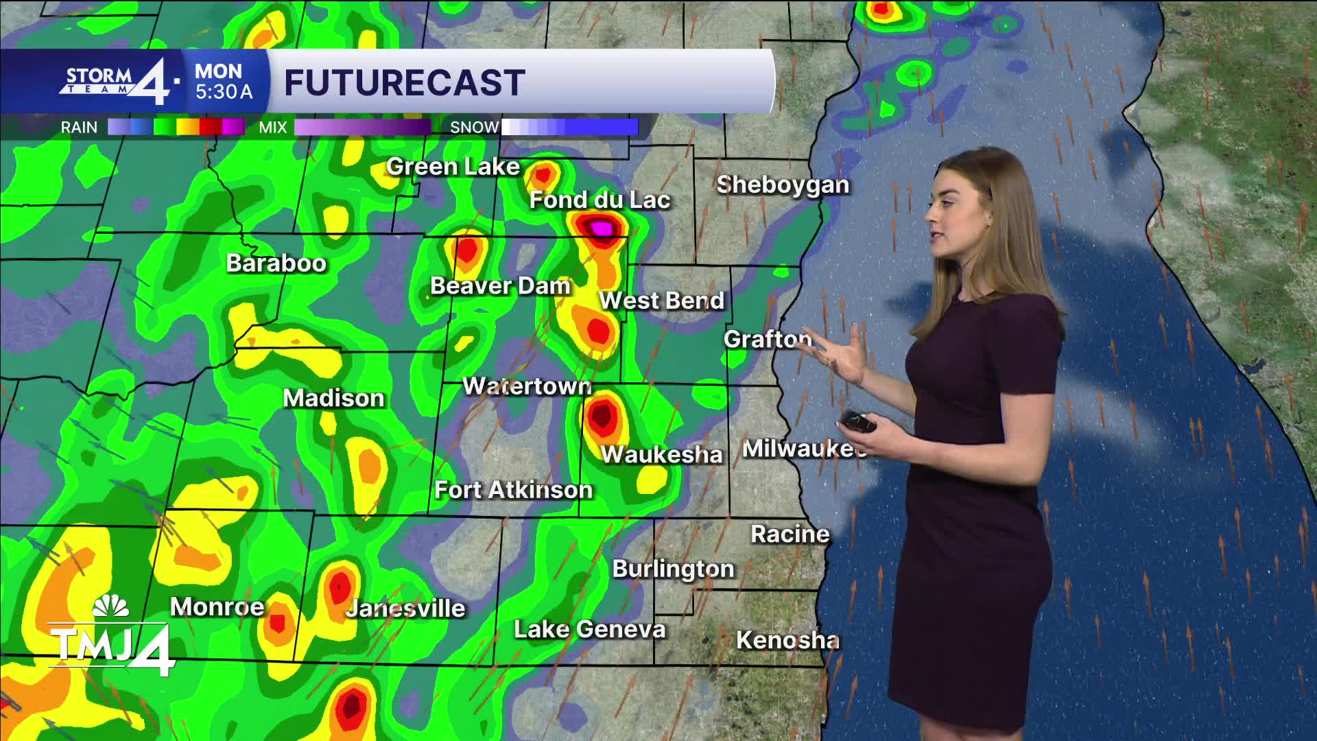
Storms are likely to roll through starting around 2 a.m. Monday. It will be a wet morning but the risk for severe weather is low.
Our highs on Monday climb back into the 80s for all of Southeast Wisconsin!
As of Sunday evening, models are suggesting we do not see storms fire up again on Monday evening.
Don't let your guard down completely. The best chance for severe storms arrives late Monday into Tuesday morning.
Storm Team 4 is still assessing the threat levels and impacts.
Temperatures remain in the 80s with high humidity for Tuesday too.
Wednesday is really when we see our temperatures return to normal.
SUNDAY NIGHT: Chance of showers/storms, mainly late.
Low: 60
Wind: SW 5-15 mph
MONDAY: Scattered t-storms, possibly severe — humid.
High: 82
Wind: W 15-30 mph
TUESDAY: Chance of showers/storms early, possibly severe — becomes partly cloudy.
High: 81
Wind: S 10-20 mph
WEDNESDAY: Partly cloudy and cooler.
High: 66
THURSDAY: Partly cloudy and cooler.
High: 55
FRIDAY: Chance of rain.
High: 63
It’s about time to watch on your time. Stream local news and weather 24/7 by searching for “TMJ4” on your device.
Available for download on Roku, Apple TV, Amazon Fire TV, and more.
