
It was nice to see the blue skies again tonight. But even with the return of sunshine, temperatures struggled to reach 40 degrees. Clouds increase tonight, and there is a chance for a few early morning flurries.
Watch: What's the Brewers Opening Day forecast?
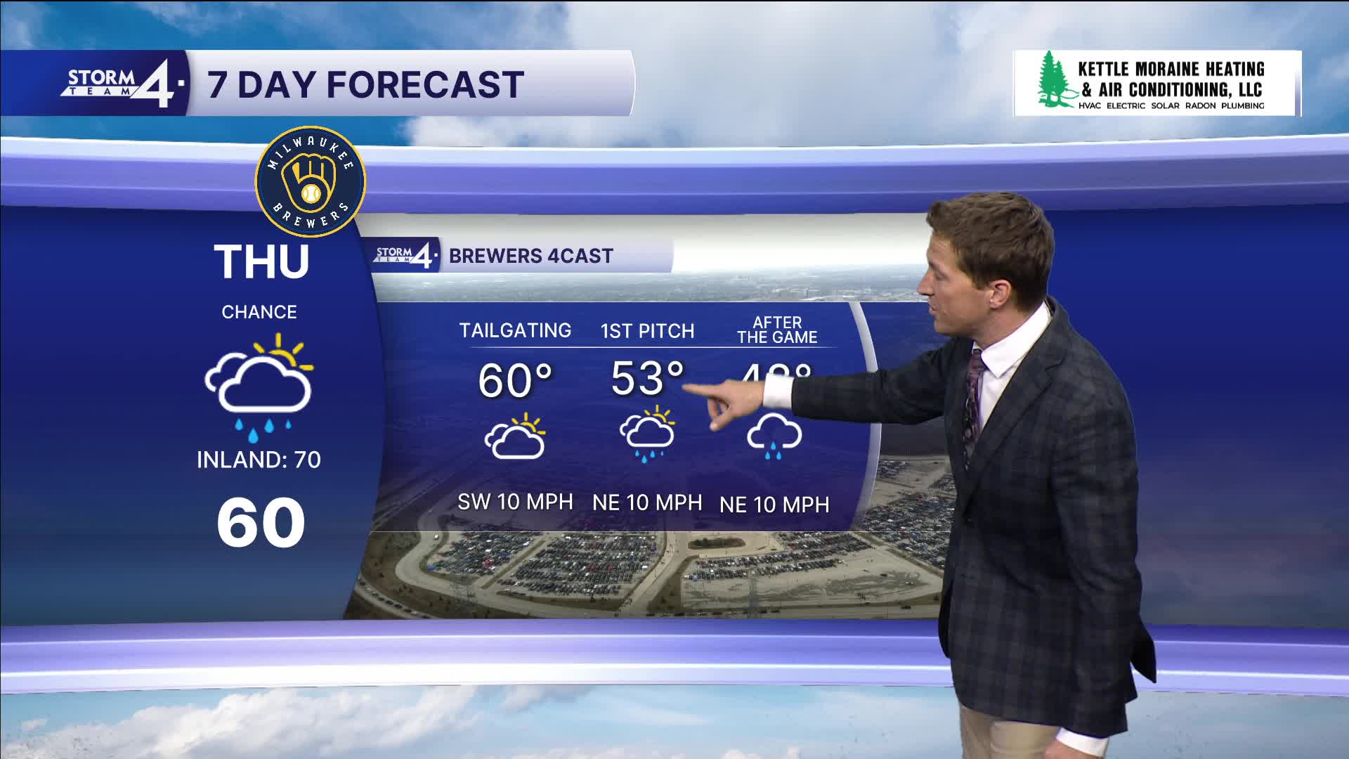
Most of the week is looking quiet until a frontal system moves in on Thursday.
This, unfortunately, means rain showers may affect Brewers Opening Day plans. The best chance for rain appears to hold off until the afternoon, so maybe most of the tailgate stays dry. It will be warmer with high temperatures around 60 degrees.
MONDAY: Mostly Sunny
High: 40
Wind: N 5-10
TONIGHT: Increasing Clouds
Low: 29
Wind: E 5 mph
TUESDAY: Partly Cloudy
High: 48
WEDNESDAY: Mostly Cloudy
High: 58
THURSDAY: Chance Rain
High: 60
FRIDAY: Partly Cloudy
High: 40
It’s about time to watch on your time. Stream local news and weather 24/7 by searching for “TMJ4” on your device.
Available for download on Roku, Apple TV, Amazon Fire TV, and more.
