

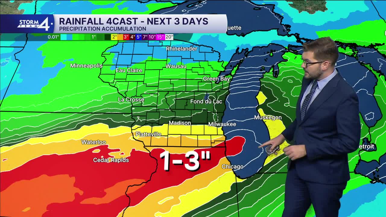


Storm Team 4 is monitoring rounds of steady to heavy rain through the middle of the week. Much of SE Wisconsin could pick up 1-3” of rainfall over 48-72 hours. Cloud cover has begun moving into the Midwest ahead of this next weather maker. Temperatures are expected to climb into the lower 70s today. Scattered showers will move over Wisconsin late tonight (generally after 10P).
Rounds of rain will continue overnight and into Wednesday. Severe weather is not expected. Periods of steady rain are expected throughout the day. Additional showers will move through the region late Wednesday and into Thursday. Heavy pockets of rain could drive totals above 1”. Locally higher amounts are possible and there is an outside chance for some flooding.
Rain will drop Southward Thursday night. Sunshine breaks back out on Friday and through much of the weekend. There is an outside chance for a few showers Saturday night. Highs will drop into the 60s over the weekend. The cooler and drier weather will make for great Fall color viewing — especially up North!
TUESDAY: Morning Sunshine; Increasing Clouds
High: 71
Wind: S 5-10 mph
TONIGHT: Scattered Showers; Mostly Cloudy
Low: 60
Wind: S 5 mph
WEDNESDAY: Rounds of Steady to Heavy Rain; Up to 1" Rainfall
High: 68
THURSDAY: Rain Likely; Up to 1" Additional Rain Possible
High: 68
FRIDAY: Partly Cloudy
High: 63
SATURDAY: Mostly Sunny
High: 61
It’s about time to watch on your time. Stream local news and weather 24/7 by searching for “TMJ4” on your device.
Available for download on Roku, Apple TV, Amazon Fire TV, and more.
