

AN AIR QUALITY ALERT IS IN EFFECT UNTIL NOON MONDAY ACROSS SE WISCONSIN. CANADIAN WILDFIRE SMOKE WILL MAKE SKIES HAZY AND LOWER AIR QUALITY INTO THE UNHEALTHY FOR SENSITIVE GROUPS (ORANGE) RANGE.
Wildfire smoke was very noticeable across SE WI today with milky to hazy skies, slightly lowered visibility, and reductions to air quality. Smoke will linger tonight, but conditions should somewhat improve for Monday. The Air Quality Alert is set to expire at Noon, and the WI DNR is forecasting Moderate (Yellow) air quality on Monday.
Watch: See the latest forecast from Storm Team 4:
Overnight lows will be in the mid 60s. Monday's highs will climb into the mid to upper 80s with increasing humidity. Skies will be mostly sunny and still a little hazy.
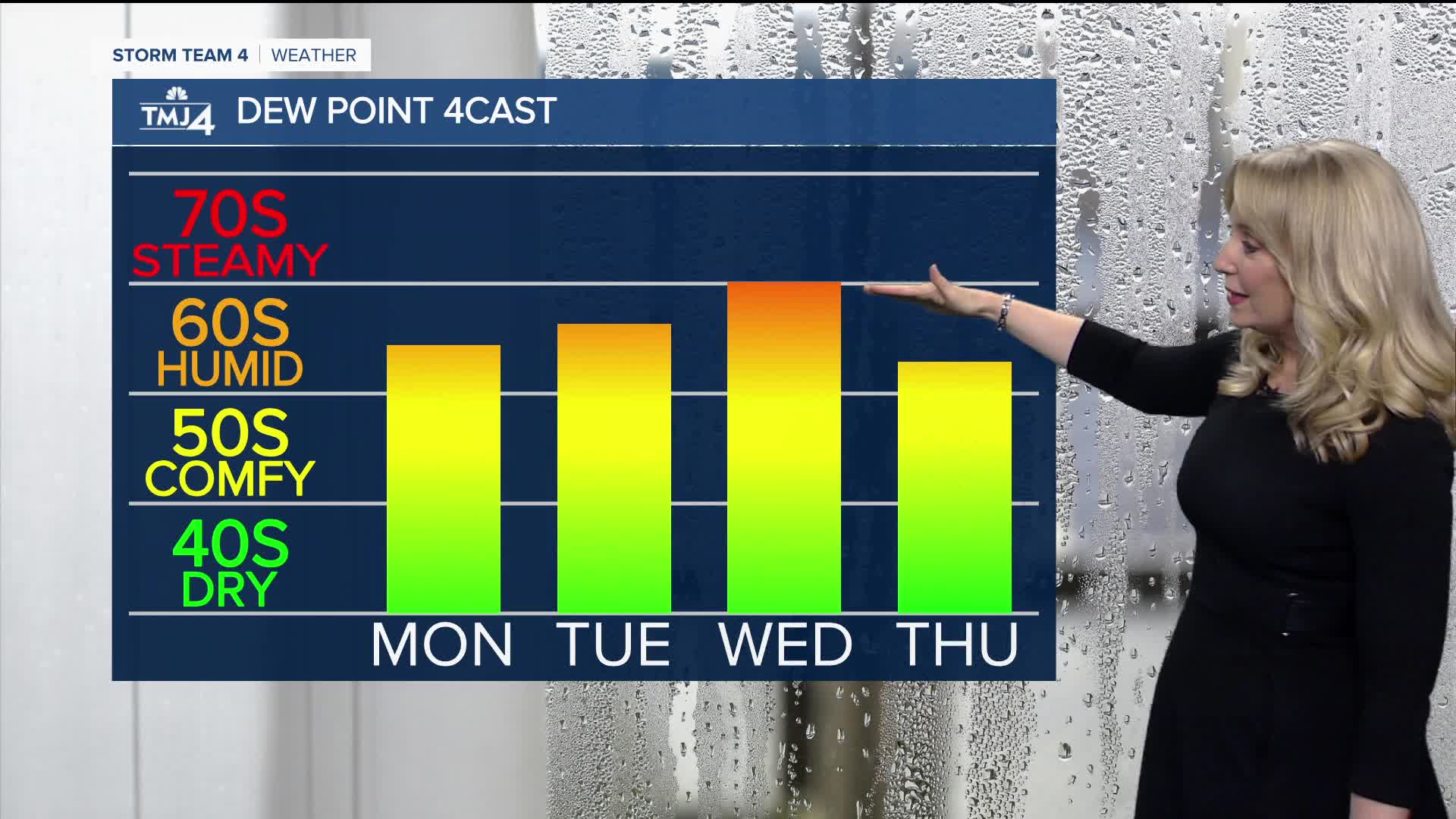
Tuesday will be warm with highs in the upper 80s and dew points in the upper 60s. We will see a slight chance for a spotty shower late Tuesday. Otherwise, the best chance for rain and storms this week will be Wednesday into Thursday.
Temperatures will be cooler late week with highs dropping back into the 70s.
TONIGHT: Smoke/Haze
Low: 66
Wind: SW 5 mph
MONDAY: Mostly Sunny, Hazy, Warm
High: 87
Wind: SW/S 5-10 mph
TUESDAY: Partly Cloudy, Chance Shower Late
High: 87
WEDNESDAY: Scattered Rain & Storms
High: 85
THURSDAY: Chance Rain & Storms
High: 76
FRIDAY: Chance Morning Shower
High: 75
It’s about time to watch on your time. Stream local news and weather 24/7 by searching for “TMJ4” on your device.
Available for download on Roku, Apple TV, Amazon Fire TV, and more.
