

The wildfire smoke is retreating; however, our air quality is still an issue due to ozone build up, especially near Lake Michigan. Skies remain mainly clear tonight with low temperatures in the 60s.
Temperatures and humidity will be on the rise tomorrow as we get close to 90 degrees in the afternoon.
Watch: When the air quality is expected to improve
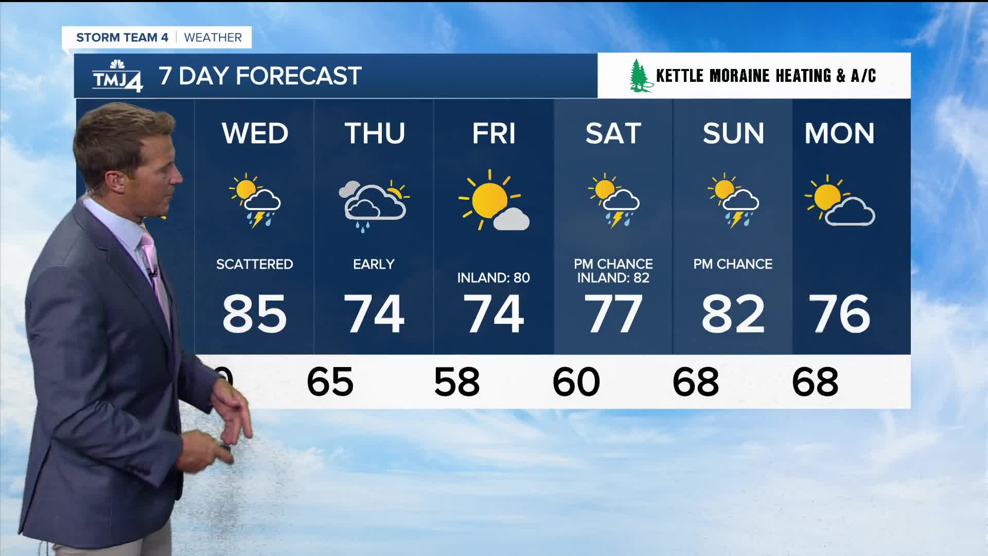
A cold front drops down from the north on Wednesday and an area of low-pressure approaches from the west. Both will combine to bring us scattered thunderstorms with he best chance in the afternoon.
A cool for summer air mass moves in behind the cold front on Thursday.
TONIGHT: Mainly Clear and More Humid
Low: 68
Wind: S 5-10 mph
TUESDAY: Sunny, Very Warm, and Humid
High: 88
Wind: SW 5-10 mph
WEDNESDAY: Partly Cloudy, Warm, and Muggy. Scattered T-Storms
High: 85
THURSDAY: Slight Ch. Showers Early and Cooler
High: 74
FRIDAY: Mostly Sunny
High: 74 Lake 80 Inland
It’s about time to watch on your time. Stream local news and weather 24/7 by searching for “TMJ4” on your device.
Available for download on Roku, Apple TV, Amazon Fire TV, and more.
