
WeatherForecastToday's Forecast

Actions

Southeast Wisconsin weather: Severe storm risk increases across the area Friday

Southeast Wisconsin weather: Severe storm risk increases across the area Friday
and last updated

Severe weather chances have increased for Friday afternoon & evening.
The Storm Prediction Center (SPC) has placed most of SE Wisconsin under a Slight (Level 2) risk for severe weather. Please stay weather aware and look for updates.

Check out the forecast:

Southeast Wisconsin weather: Severe storm risk increases across the area Friday

A cold front will trigger two rounds of rainfall today. One is already underway early Friday morning. Scattered showers and storms were ongoing across central Wisconsin. An overall weakening trend is expected as this first round nears Milwaukee by mid/late morning. These storms could contain gusty winds and downpours.

Given increasing dew points, more instability and the presence of the cold front, a second round of storms is expected to develop across southern Wisconsin late this afternoon and into the evening hours. The strongest storms could contain damaging winds and/or hail. An isolated tornado cannot be ruled out.

Storms clear the region after 10P.

A spotty shower or storm is possible along the lake breeze on Saturday. These storms could also produce gusty winds and downpours.
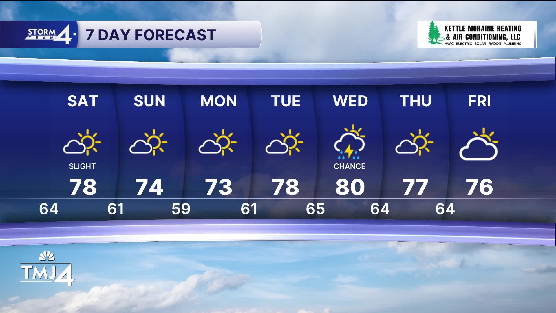
Most of Saturday will be dry and sunny with highs in the upper 70s. Cooler & comfortable weather returns Sunday and early next week.

FRIDAY: Chance AM Showers; PM Strong Storms Possible
High: 78
Wind: SW 5-10 mph

TONIGHT: Storms Ending; Partly Cloudy
Low: 64
Wind: SW/NW 5-10 mph

SATURDAY: Slight Chance Pop-up Shower/Storm; Mostly Sunny
High: 78
Wind: NW 10 mph

SUNDAY: Cooler and less humid
High: 74

MONDAY : Sunny
High: 73

TUESDAY: Mostly Sunny; Slight Chance PM Rain
High: 78


It’s about time to watch on your time. Stream local news and weather 24/7 by searching for “TMJ4” on your device.

Available for download on Roku, Apple TV, Amazon Fire TV, and more.