



We wrapped up the wettest April on record with over 9 inches of rain. It was also the 8th warmest April. Temperatures are certainly cooler to kick off May.
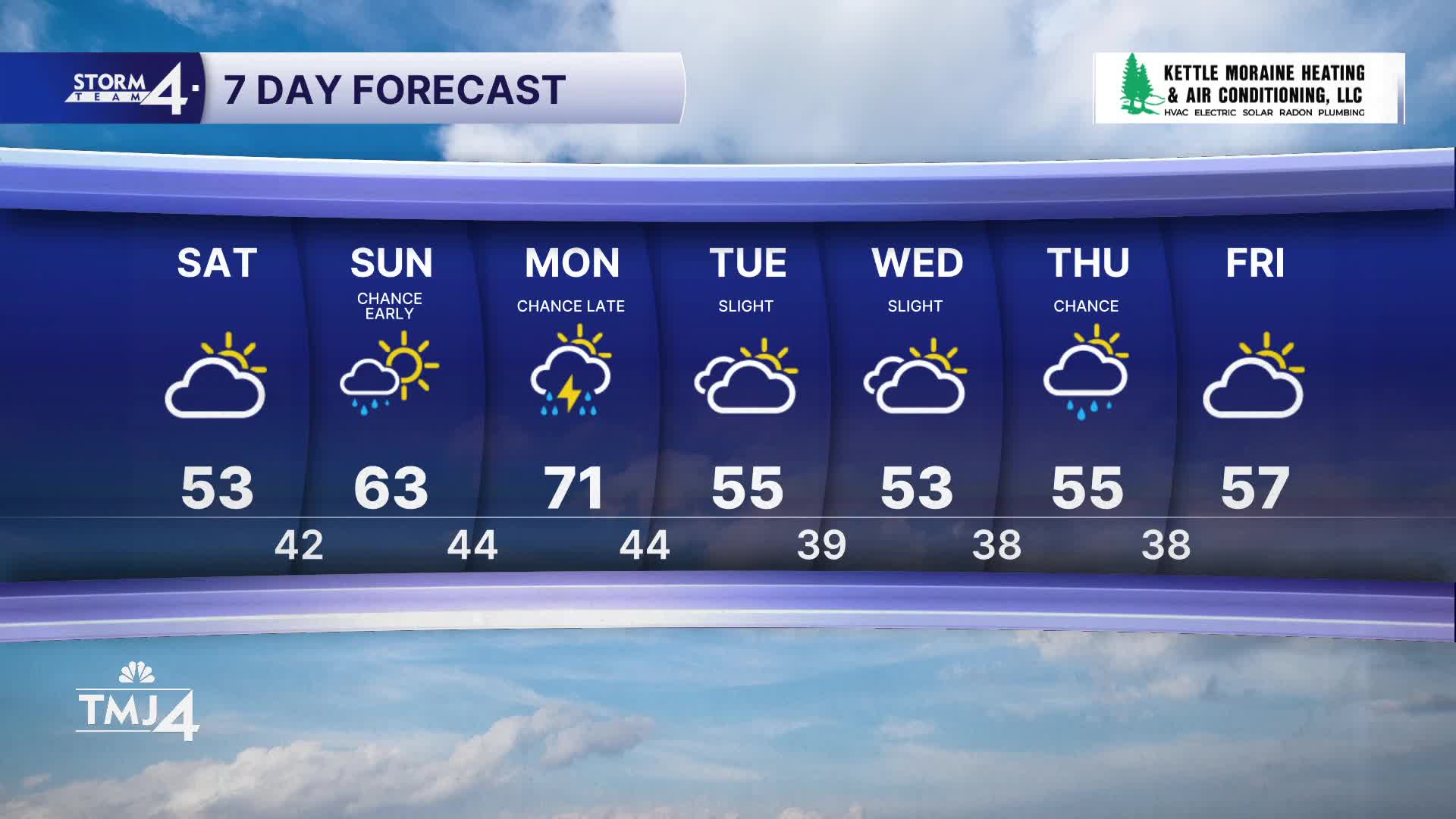
It was a sunny spring Saturday. High temperatures made it to the low 50s. More clouds build in tonight. We could see a few showers early Sunday morning. For the most part, this is unimpactful. Sunday afternoon we will see some sunshine.
Warmer temperatures are back on Sunday. Highs will be in the 60s, which is normal for early May.
Monday will be mostly sunny and warm with highs in the 70s. As an area of low pressure sits over Wisconsin and a cold front sweeps through in the evening, we could see some strong storms. While some severe weather could be possible, we are not expecting anything widespread.
Cooler temperatures sink in for the rest of the week. Expect highs in the 50s.
WATCH: Will we see more showers on Monday?
HERE'S YOUR LATEST STORM TEAM WEATHER FORECAST FOR MILWAUKEE
AND SOUTHEASTERN WISCONSIN BY METEOROLOGIST LAUREN LARSEN
TONIGHT: Mostly Cloudy Scattered Showers
Low: 42
Wind: SW 5-10 mph
SUNDAY: Early Showers Chance; Mostly Sunny
High: 63
Wind: SW 15-30 mph
MONDAY: Partly Cloudy; Chance PM Showers/Storms
High: 70
Wind: S 5-10 mph
TUESDAY: Slight Chance Showers; Partly Sunny
High: 57
WEDNESDAY: Mostly Cloudy
High: 55
THURSDAY: Chance Showers
High: 55
It’s about time to watch on your time. Stream local news and weather 24/7 by searching for “TMJ4” on your device.
Available for download on Roku, Apple TV, Amazon Fire TV, and more.
