
Severe Thunderstorm Warning in effect until 9:30 p.m. for Racine and Walworth counties.
We saw a widespread 1-3 inches of rain on Thursday. We have river flood warnings in effect for Lower Fox River near New Munster and Root River at Raymond through Tuesday due to more precipitation on the way.
Thunderstorms are likely tonight. A few storms may be strong to severe. Hail and gusty winds are the biggest concerns in the strongest storms. There is a marginal risk for severe weather; to add context we had a level 3 risk with the storms from Thursday night. We could see another 1/2"-1" of rain Overnight as lows drop into the upper 30s.
Watch: When rain could return next week:
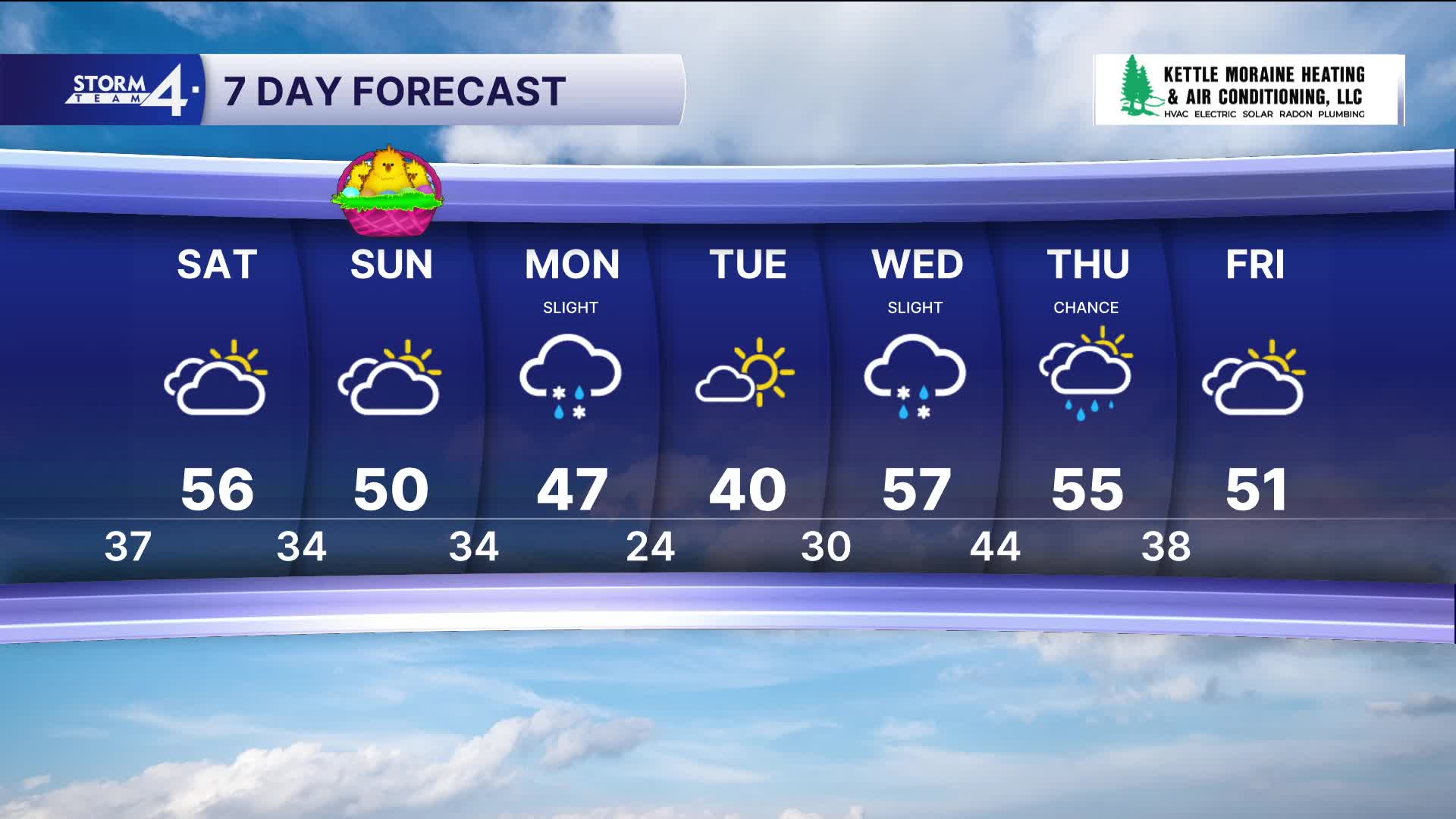
Scattered showers are possible Saturday morning. Highs remain in the lower to mid-50s.
Easter Sunday looks to remain dry. We will see mostly cloudy skies and breezy westerly winds.
There is another chance for showers on Monday, but it is more likely to rain Wednesday and Thursday.
Stay tuned to Storm Team 4 on air and online for the latest weather updates.
TONIGHT: Scattered Storms
Severe Risk level 1, primary threat hail: Midnight - 2A
Low: 37
Wind: W 10-15 mph
SATURDAY: Scattered AM Showers Likely
High: 56
Wind: W 15-20 mph
SUNDAY: Mostly Cloudy
High: 50
Winds: W 10-20 G30 mph
MONDAY: Chance Showers
High: 48
Wind: NW 10-20
TUESDAY: Mostly Sunny
High: 42
WEDNESDAY: Chance Mix
High: 57
THURSDAY: Chance Showers
High: 60
It’s about time to watch on your time. Stream local news and weather 24/7 by searching for “TMJ4” on your device.
Available for download on Roku, Apple TV, Amazon Fire TV, and more.
