

Late tonight clouds will increase as a complex of storms tracks southeast from SD and MN, with the remnants arriving in Wisconsin by early Tuesday morning. We will be left with a few showers and clouds around to start Tuesday. Morning temperatures will be in the low 70s.
Tuesday afternoon will still be hot and humid with highs in the upper 80s and low 90s and dew points in the upper 60s. Pop up t-showers are possible mid-day.
Heat and humidity are ramping up:
A cooler and less humid period of weather takes hold later in the week. Showers linger Wednesday, but we will be dry Thursday and Friday. Highs will stay in the 70s with overnight lows close to 60-degrees, a refreshing stretch!
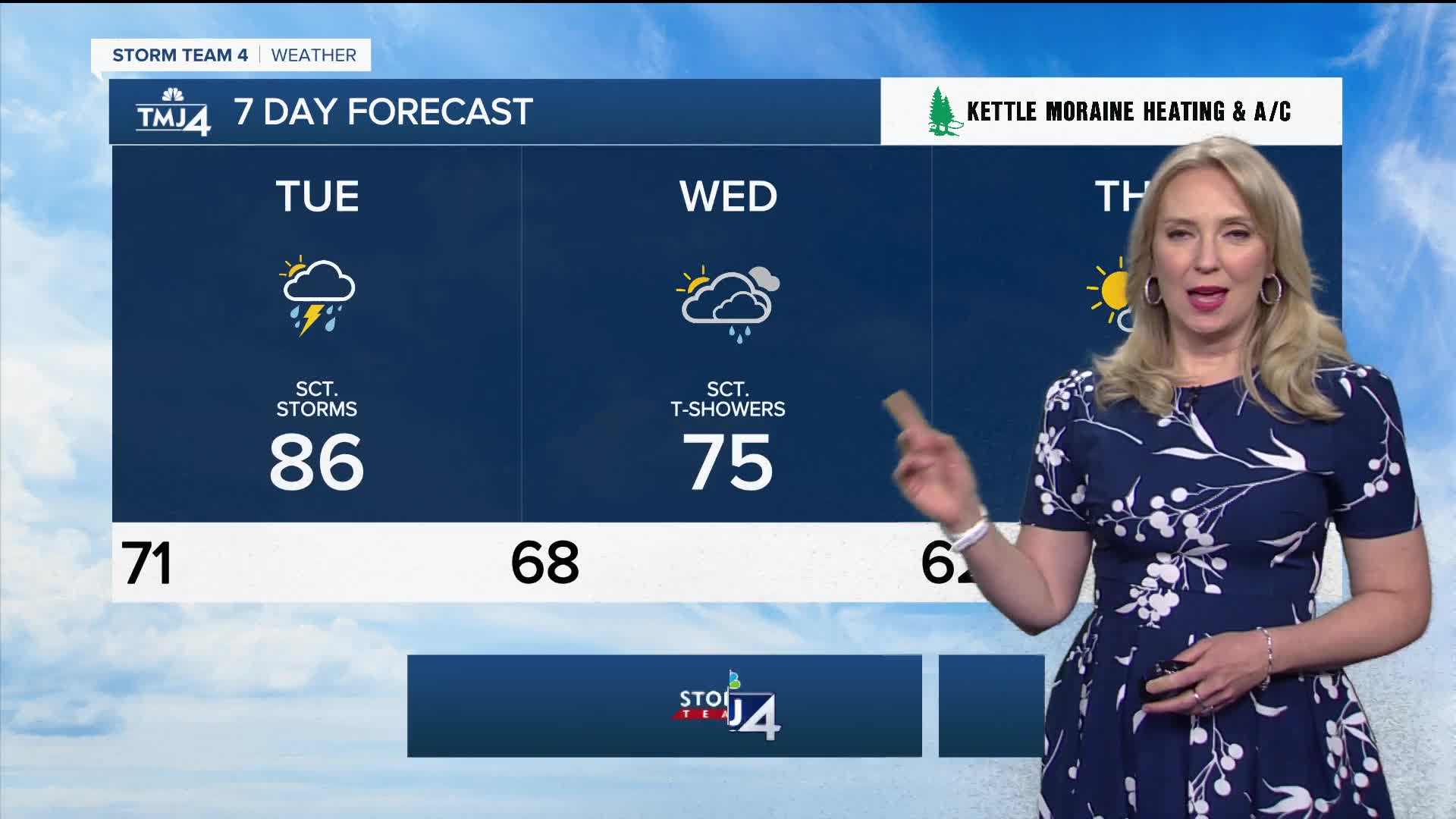
TONIGHT: Increasing Clouds, Ch. Shower by Morning
Low: 71
Wind: S/W 5-10 mph
TUESDAY: AM Chance Showers, Pop up Aft T-Shower, Hot & Humid
High: 86 lake, 91 inland
Wind: Var 10-15 MPH
WEDNESDAY: Chance Shower/Storm; Cooler
High: 75
THURSDAY: Partly Sunny & Breezy
High: 73
FRIDAY: Mostly Sunny
High: 74
SATURDAY: Mainly Sunny
High: 74
It’s about time to watch on your time. Stream local news and weather 24/7 by searching for “TMJ4” on your device.
Available for download on Roku, Apple TV, Amazon Fire TV, and more.
