

I really hope you enjoyed the comfort of today because the heat comes back in a big way by midweek.
It'll be a very nice evening to have dinner outdoors and overnight low temperatures will be in the 60s. Tomorrow will be warmer but still very nice.
When is extreme heat expected?:
The heat cranks up on Wednesday. Along with temperatures reaching the 90s, it's also going to be extremely humid. Dew points will climb well into the 70s and maybe even close to 80.
High heat and humidity continue into Thursday, but possible storms may help cool things down a bit.
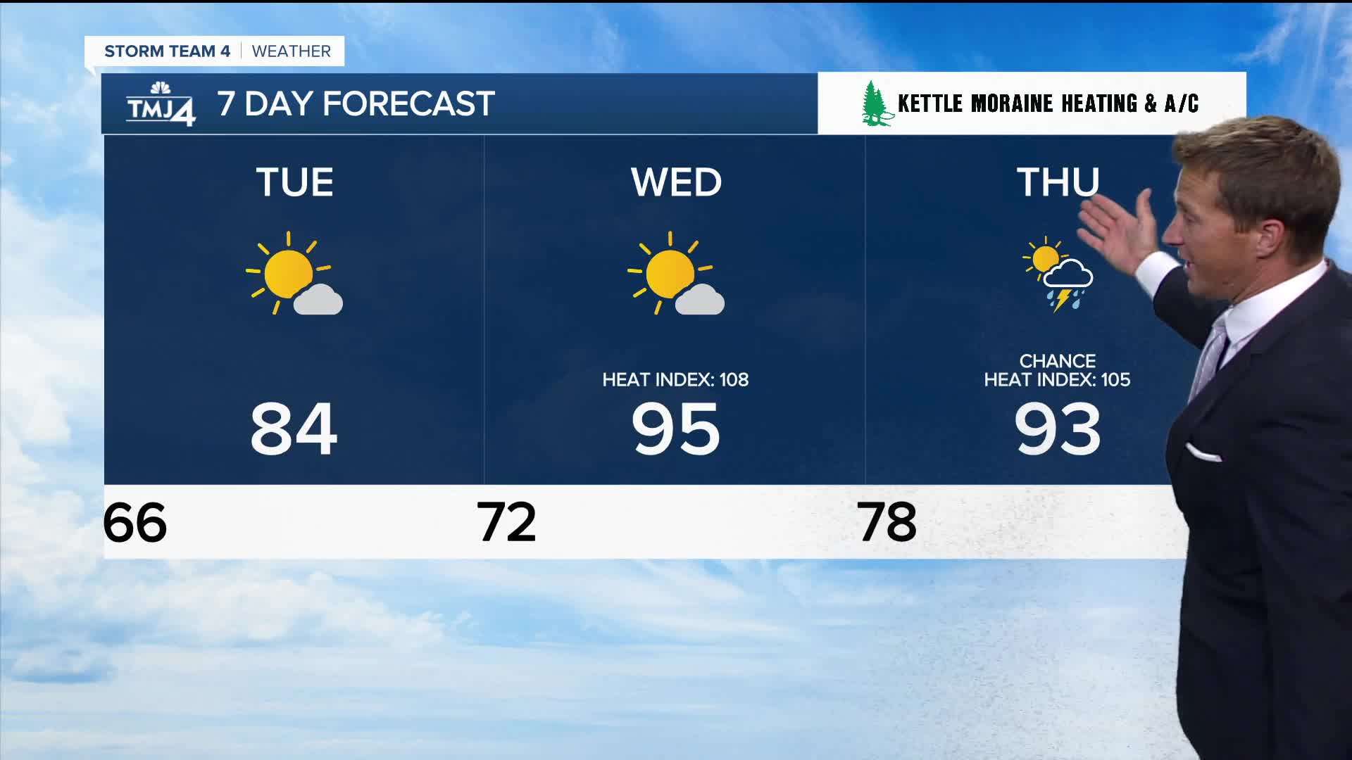
TONIGHT: Mainly Clear
Low: 66
Wind: NE 5 mph
TUESDAY: Mostly Sunny and Warmer
High: 84
Wind: NE 5 mph
WEDNESDAY: Mostly Sunny, Hot, and extremely Humid
High: 95, Heat Index Up to 108
THURSDAY: Partly Cloudy, Hot, and extremely humid. Ch. T-Storms
High: 93, Heat Index Up to 105
FRIDAY: Partly Cloudy. Slight Ch. Showers/Storms
High: 85
It’s about time to watch on your time. Stream local news and weather 24/7 by searching for “TMJ4” on your device.
Available for download on Roku, Apple TV, Amazon Fire TV, and more.
