

We finally have some relief from the smoke today that should for the foreseeable future. A more south atmospheric flow should continue to usher out the Canadian wildfire smoke, but it will naturally also heat us up.
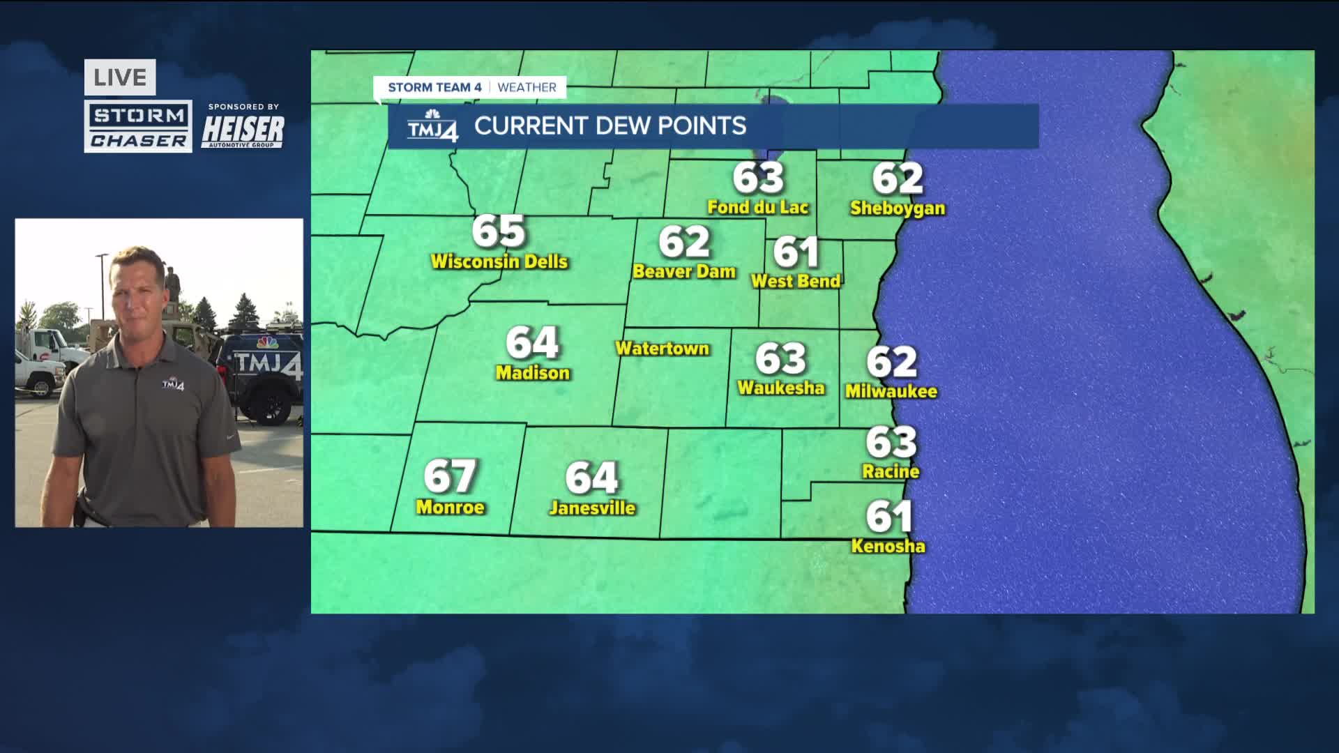
It's going to feel more humid tonight and we're going to climb well into the 80s tomorrow. The heat and humidity should create enough instability for a few thunderstorms to develop along a warm front tomorrow afternoon. The best chance for storms appears to be north of Milwaukee.
Watch: Heat and humidity ramping up
More storms may pop up on Friday. High temperatures on Friday and into the weekend may top out around 90 and the humidity will make it feel like the upper 90s.
TONIGHT: Partly Cloudy and Humid
Low: 68
Wind: Calm
THURSDAY: Mostly Sunny, Warm, and Humid. Ch. PM T-Storms
High: 85
Wind: NE 10-20 mph
FRIDAY: Partly Cloudy, Hot, and Humid with Scattered Showers/Storms
High: 90
SATURDAY: Mostly Sunny, Hot, and Humid
High: 92
SUNDAY: Partly Cloudy, Very Warm, and Humid
High: 88
It’s about time to watch on your time. Stream local news and weather 24/7 by searching for “TMJ4” on your device.
Available for download on Roku, Apple TV, Amazon Fire TV, and more.
