


You can feel the humidity on the increase and that trend continues tonight. Low temperatures will be in the lower 70s, and the dew point also rises into the 70s.
The combination of temperatures in the 90s and dew points well into the 70s will make it feel as hot as 105 tomorrow afternoon. More clouds and storm chances may suppress the heat slightly on Thursday.
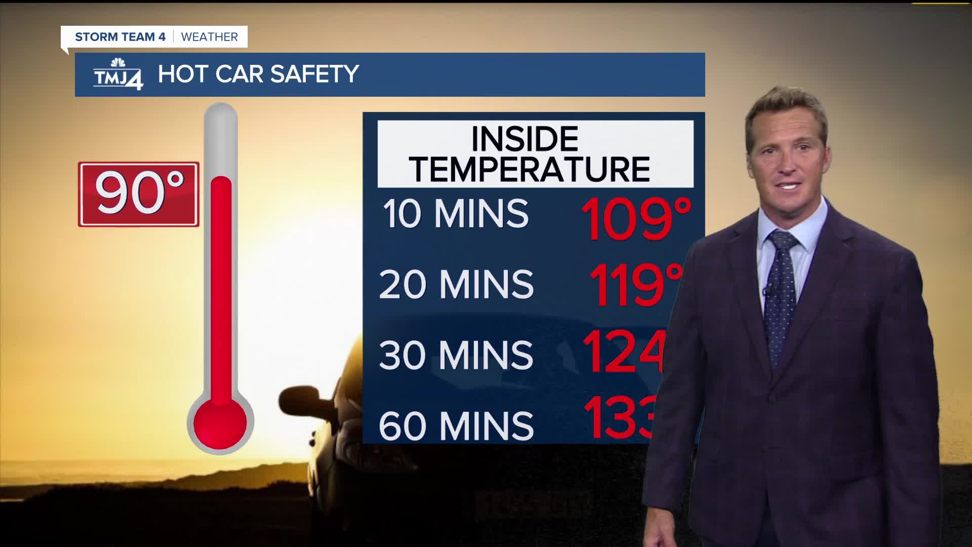
When heat & humidity ramp up:
Storms will track mainly north of the area on Wednesday, however there is a slight chance for Fond du Lac and Sheboygan to get clipped. There is a much greater risk for storms on Thursday as a cold front sags down from the north.
TONIGHT: Mainly Clear and Muggy
Low: 73
Wind: S 5-10 mph
WEDNESDAY: Mostly Sunny, Hot, and Very Humid. Scattered T-Storms
High: 94, Heat Index: Up To 105
Wind: S 10-15 mph
THURSDAY: Partly Cloudy, Hot, and Very Humid. Chance T-Storms
High: 92, Heat Index: Up to 103
FRIDAY: Partly Cloudy and Still Humid. Ch. Showers/Storms
High: 83
SATURDAY: Partly Cloudy, Warm, and Humid. Slight Ch. T-Storms
High: 85
It’s about time to watch on your time. Stream local news and weather 24/7 by searching for “TMJ4” on your device.
Available for download on Roku, Apple TV, Amazon Fire TV, and more.
