

Morning rain held the heat off for the first half of the day, but temperatures are skyrocketing this afternoon. Most locations will top out above 90 degrees with high humidity making it feel 100+. Extremely high dew points are approaching 80 degrees in spots.
We'll stay very muggy tonight with overnight lows in the middle to upper 70s. It'll be another steamy day tomorrow with similar numbers expected.
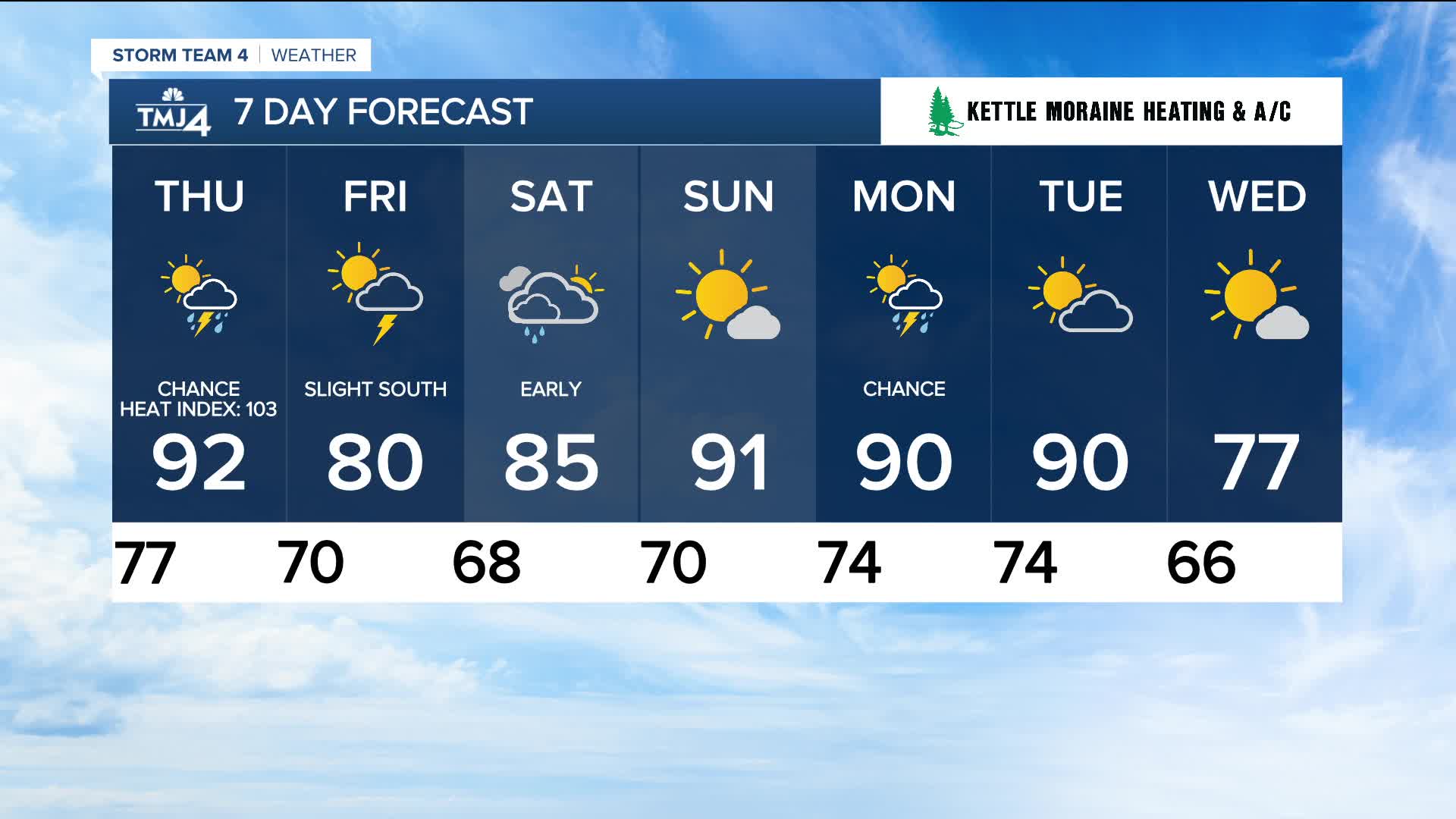
Just how hot it'll get Thursday:
Storms stay to our north tonight but will expand toward us during the day tomorrow. Our best chance for storms will be in the afternoon. The severe threat is relatively low along with localized heavy rain possible.
TONIGHT: Partly Cloudy and Very Muggy
Low: 77
Wind: SW 5-10 mph
THURSDAY: Partly Cloudy, Hot, and Humid. Ch. PM T-Storms
High: 80 Lake 85 Inland
Wind: SW 10-15 mph
FRIDAY: Partly Cloudy and Still Humid. Slight Ch. T-Storms South
High: 85
SATURDAY: Ch. Showers Early. Mostly Sunny, Warm, and Humid
High: 85
SUNDAY: Mostly Sunny, Hot and Humid.
High: 91
MONDAY: Partly Cloudy, Hot, and Humid. Ch. Showers and T-Storms
High: 90
It’s about time to watch on your time. Stream local news and weather 24/7 by searching for “TMJ4” on your device.
Available for download on Roku, Apple TV, Amazon Fire TV, and more.
