

With clear skies and calming winds, heads up for the potential of frost tonight. Temperatures may dip near freezing, especially away from Lake Michigan.
Another cooler-than-normal day is on the way for Wednesday
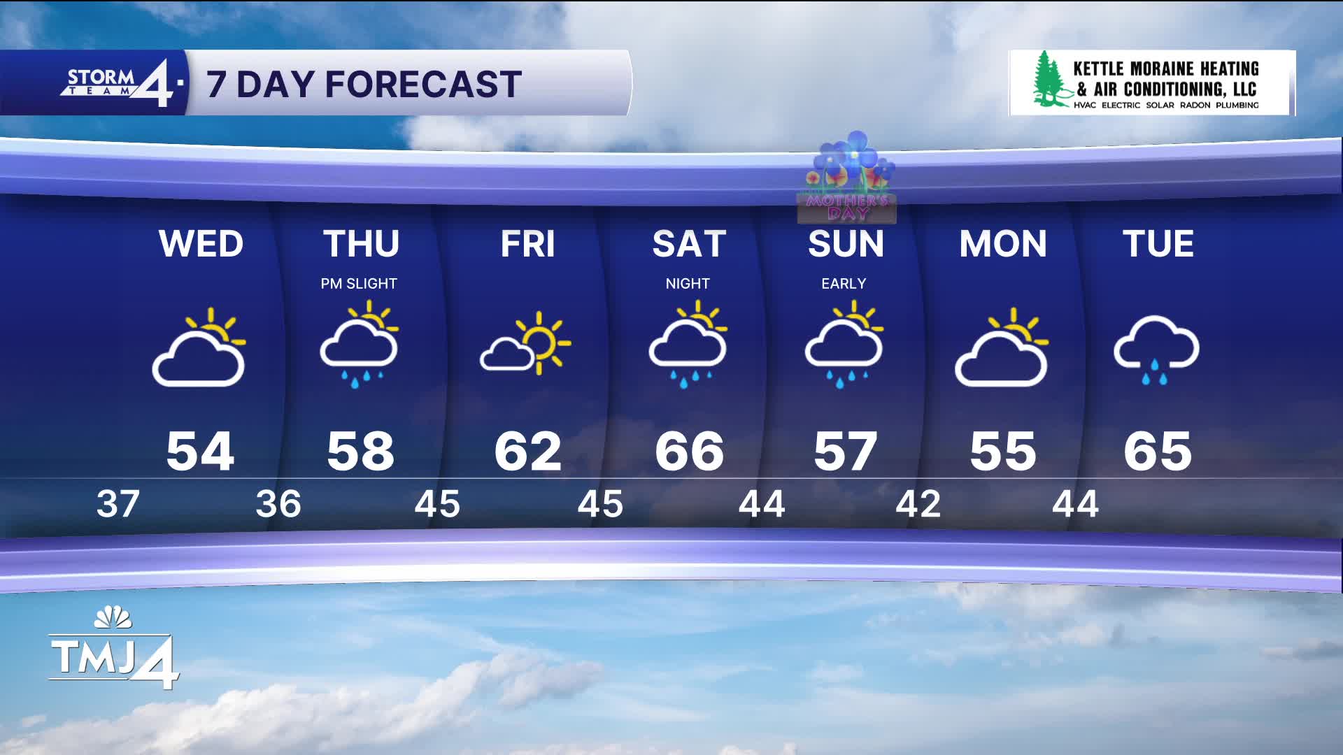
Southeast Wisconsin weather: Cooler week ahead
We're timing out our next couple chances for rain. The first chance will be a very small chance for showers Thursday afternoon.
A much better chance for rain arrives Saturday night and into Sunday morning.
On a positive note, this earlier arrival of weekend rain would mean most of Mother's Day would be dry.
WATCH: Interview with UWM Panthers Baseball coach about UWM Baseball weather show
TONIGHT: Mainly Clear. Some Frost Possible Inland
Low: 37 Lake 33 Inland
Wind: NW 5-10 mph
WEDNESDAY: Partly cloudy
High: 54
Wind: NW to E 10 mph
THURSDAY: Partly Cloudy. PM Widely Scattered Showers/Storms
High: 58
FRIDAY: Mostly Sunny
High: 62
SATURDAY: Partly Cloudy Then Rain By Night
High: 66
It’s about time to watch on your time. Stream local news and weather 24/7 by searching for “TMJ4” on your device.
Available for download on Roku, Apple TV, Amazon Fire TV, and more.
