

A Winter Weather Advisory will be in effect from 1 a.m. until 9 a.m. Thursday for Washington, Ozaukee, Sheboygan, Fond du Lac, and Dodge Counties.
Today was cool and breezy, with many of us stuck with temps in the 30s.
An area of low pressure is creeping towards Wisconsin. Tonight, we could see a slushy mix across Southeast Wisconsin.
There is a better chance for mix and potentially some freezing rain to the north. We could see ice accumulations up to 0.2".
WATCH: Southeast Wisconsin weather: Cooler temperatures and scattered showers
South of 94, precipitation is mostly rain. This will be a cold steady rain. You will likely see 1/2-3/4 inch in the gauge from this system.
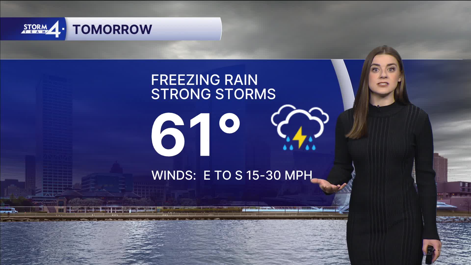
Warmer weather is back as a warm front pushes north on Thursday as our temps hit 60 degrees. Along this front, we could see some strong to severe storms.
The main timing for severe storms is 4P-9P Thursday. Southeast Wisconsin is under a slight (level 2) and enhanced (level 3) risk. All impacts are possible.
This wraps up by 10P Thursday night.
Friday will be mild.
Showers return for Saturday with highs in the mid-50s.
Easter Sunday looks to remain dry.
Stay tuned to Storm Team 4 on air and online for the latest weather updates.
TONIGHT: Wintry Mix North; Showers Likely
Low: 34
Wind: E 10-15 G 30 mph
THURSDAY: Rain Likely, 1/2" or more; Windy
High: 61
Wind: E to S 10-15 G 30 mph
FRIDAY: Becoming Sunny; Mild
High: 58
SATURDAY: Rain Showers Likely
High: 58
SUNDAY: Mostly Cloudy
High: 50
MONDAY: Chance Showers
High: 48
It’s about time to watch on your time. Stream local news and weather 24/7 by searching for “TMJ4” on your device.
Available for download on Roku, Apple TV, Amazon Fire TV, and more.
