

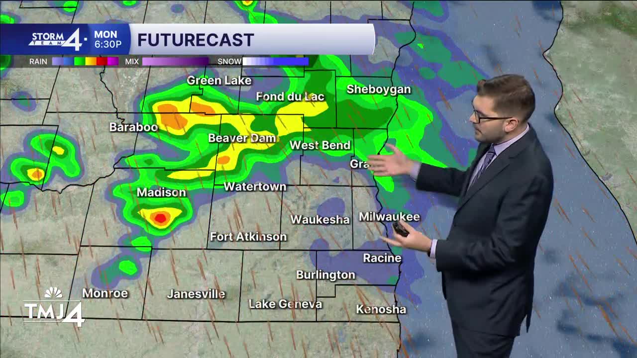


Fall has certainly sprung up this morning across southern Wisconsin! Overnight lows have tumbled into the 40s & 50s across much of the area! High-pressure quickly moves Eastward today — allowing more cloud cover to spread into the region. Highs climb into the lower 70s. Scattered showers and storms move into Wisconsin later this afternoon & evening. A few could clip parts of SE Wisconsin.
The better opportunity for rain arrives tonight and into Tuesday morning. Rounds of steady to heavy rain will move across southern Wisconsin and northern Illinois. Repeated rounds of rain could lead to isolated ponding and higher rainfall totals. Overall, a half-inch of rain appears possible for much of the area. Isolated totals of up to 1" are possible in repeated rounds of rainfall.
Scattered showers and storms will come to a close on Tuesday afternoon. Another area of high-pressure will move into the Great Lakes later in the week. This will be a main feature to monitor as it could reduce rain chances on Wednesday and Thursday. As of now, rain chances will be held in the 4Cast. If the high settles a bit farther southward, this could keep drier air over southern Wisconsin. If it remains farther North, we could see more rounds of rain.
Highs remain in the 70s through this week's rainy pattern.
MONDAY: Increasing Clouds, PM Storms Possible
High: 70
Wind: SE 10-15 mph
TONIGHT: Showers/Storms Likely; Cloudy & Breezy
Low: 63
Wind: S 15-20 G 30 mph
TUESDAY: Chance Showers; Breezy & Cloudy
High: 76
Wind: W 10-20 G 25 mph
WEDNESDAY: Partly Cloudy, Chance Showers
High: 70
THURSDAY: Partly Cloudy, Chance Showers
High: 72
FRIDAY: Partly Cloudy, Chance Showers
High: 72
It’s about time to watch on your time. Stream local news and weather 24/7 by searching for “TMJ4” on your device.
Available for download on Roku, Apple TV, Amazon Fire TV, and more.
