

**A Beach Hazard Statement is in effect for the beaches of Milwaukee, Racine, and Kenosha counties. 4-6 foot wavs and dangerous currents mean beach goers need to stay out of the water.
Much cooler temperatures are moving in behind our cold front, and drier air will slowly move in, lowering humidity levels. Overnight lows will drop to around 60-degrees with rain ending and partial clearing.
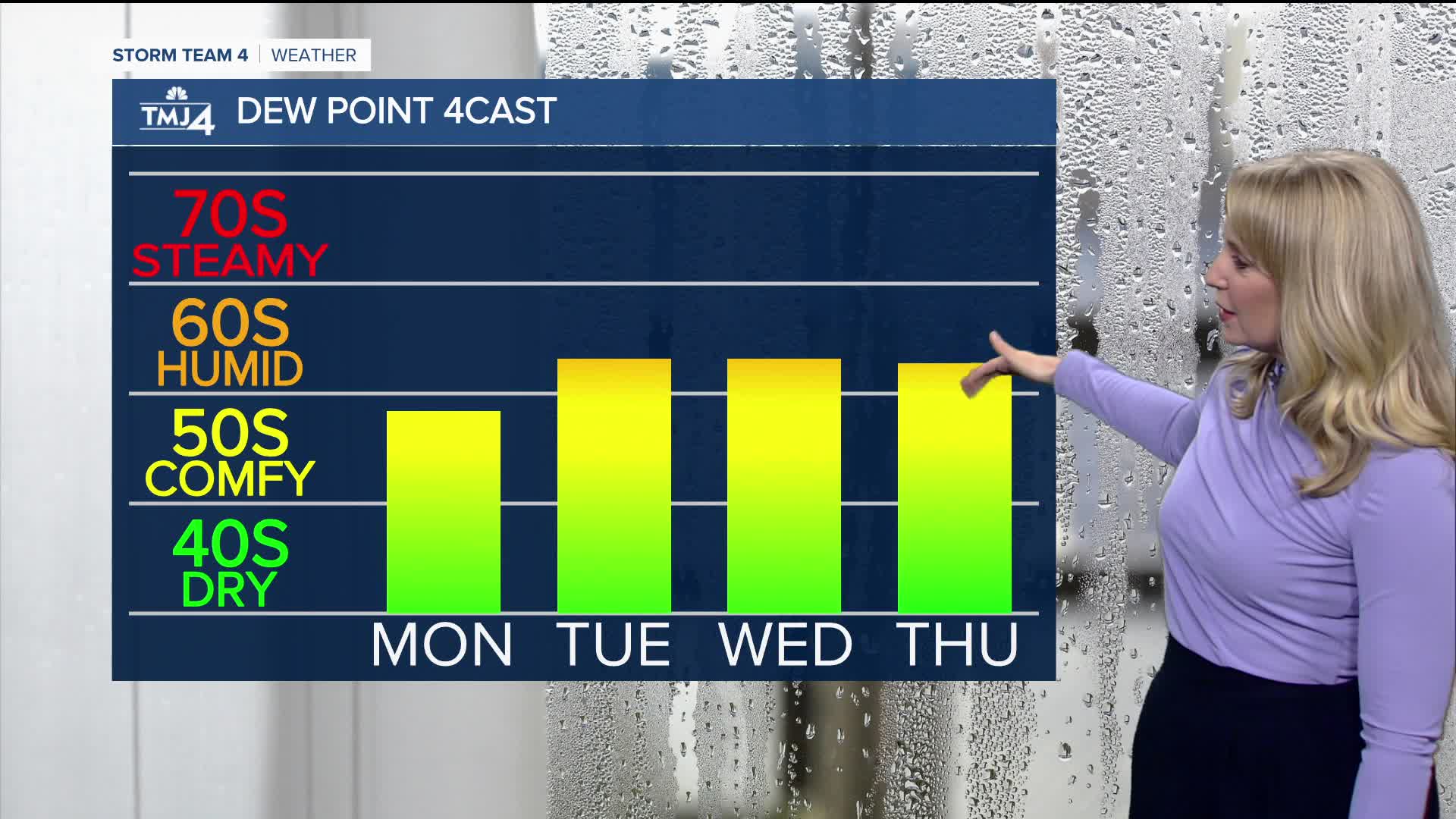
Monday will be a beautiful day with mostly sunny to partly cloudy skies. Temperatures will top out in the mid 70s near the lake and in the low 80s inland. Dew points will be in the upper 50s, giving us a nice break from the humidity.
Pop-up showers and storms return Tuesday into Wednesday with highs near 80. Thursday looks dry, with another round of rain and storms expected Friday into Saturday.
TONIGHT: Partly Cloudy
Low: 60
Wind: NE/N 10-15 mph
MONDAY: Mostly Sunny to Partly Cloudy
High: 75 lake, 81 inland
Wind: NE 5-10 mph
TUESDAY: Partly Sunny; Scattered Rain/Storms
High: 80
WEDNESDAY: Scattered Showers/Storms; Partly Cloudy
High: 80
THURSDAY: Mostly Sunny
High: 77
FRIDAY: Scattered Showers & Storms
High: 85
It’s about time to watch on your time. Stream local news and weather 24/7 by searching for “TMJ4” on your device.
Available for download on Roku, Apple TV, Amazon Fire TV, and more.
