

What a change of pace today with clouds and a cool northeast breeze. It's a great opportunity to open up the windows to get some fresh air in the house. Low temperatures will range from around 60 in Milwaukee to the middle 50s inland.
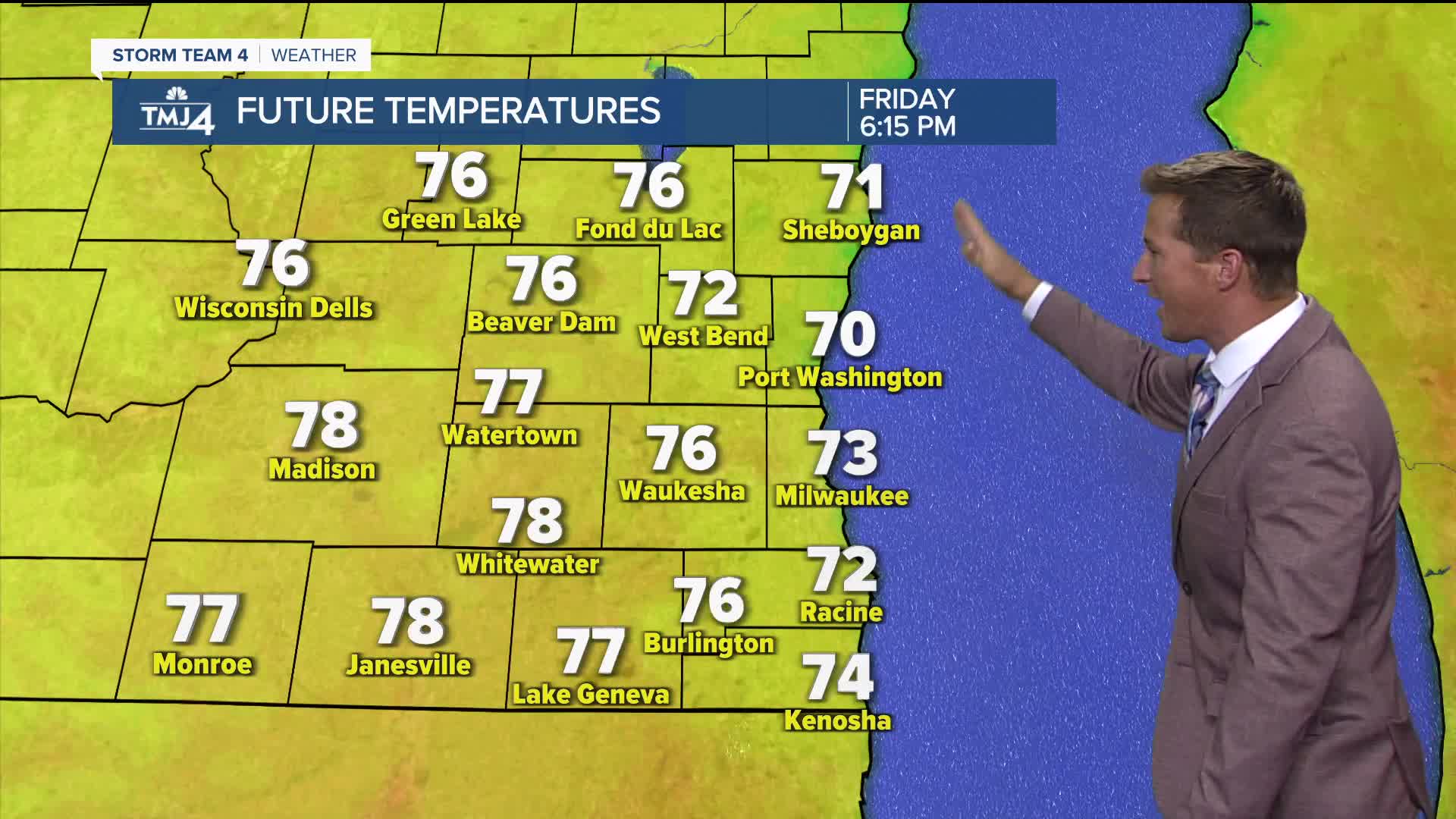
Near perfect weather is on the way for Friday with a lot more sunshine and high temperatures ranging from the 70s lakeside to around 80 inland.
When humidity and storm chances return:
There is so much going on this weekend, and we'll have to keep an eye on the skies throughout the day on Saturday with the potential for scattered showers and storms.
TONIGHT: Mainly Clear and Cool
Low: 60 Lake 55 Inland
Wind: NE 5-10 mph
FRIDAY: Mostly Sunny and Comfortable
High: 75 lake 80 Inland
SATURDAY: Partly Cloudy with Scattered Showers and T-Storms
High: 80
SUNDAY: Mostly Sunny
High: 75
MONDAY: Partly Cloudy
High: 77
It’s about time to watch on your time. Stream local news and weather 24/7 by searching for “TMJ4” on your device.
Available for download on Roku, Apple TV, Amazon Fire TV, and more.
