

We warmed up quickly today after morning lows in the single digits and teens. The sun and a brisk SW wind to 25 mph got high temps near 40 with wind chills near 30.
There will be a few clouds overnight as a cold front moves through with no precipitation. Morning lows will be in the low to mid-20s, and by afternoon we stay in the 30s despite enjoying another sunny day. The NW wind will be chilly keeping wind chills near 20.
Clouds increase on Thursday with highs only in the upper 20s, and the chance for light snow increases by evening.
By Friday morning, most of us will see 1-2" of snow. Friday afternoon sees some sun with highs in the low 30s and a gusty NW wind.
Saturday is windy and cold with morning lows in the teens and highs in the upper 20s. NW winds will gust to near 30, and wind chills will be in the teens all day.
Sunday morning is in the teens, but we quickly warm up into the low 40s with a gusty SW wind. Monday is in the mid 40s with rain showers likely
TONIGHT: Partly cloudy and chilly
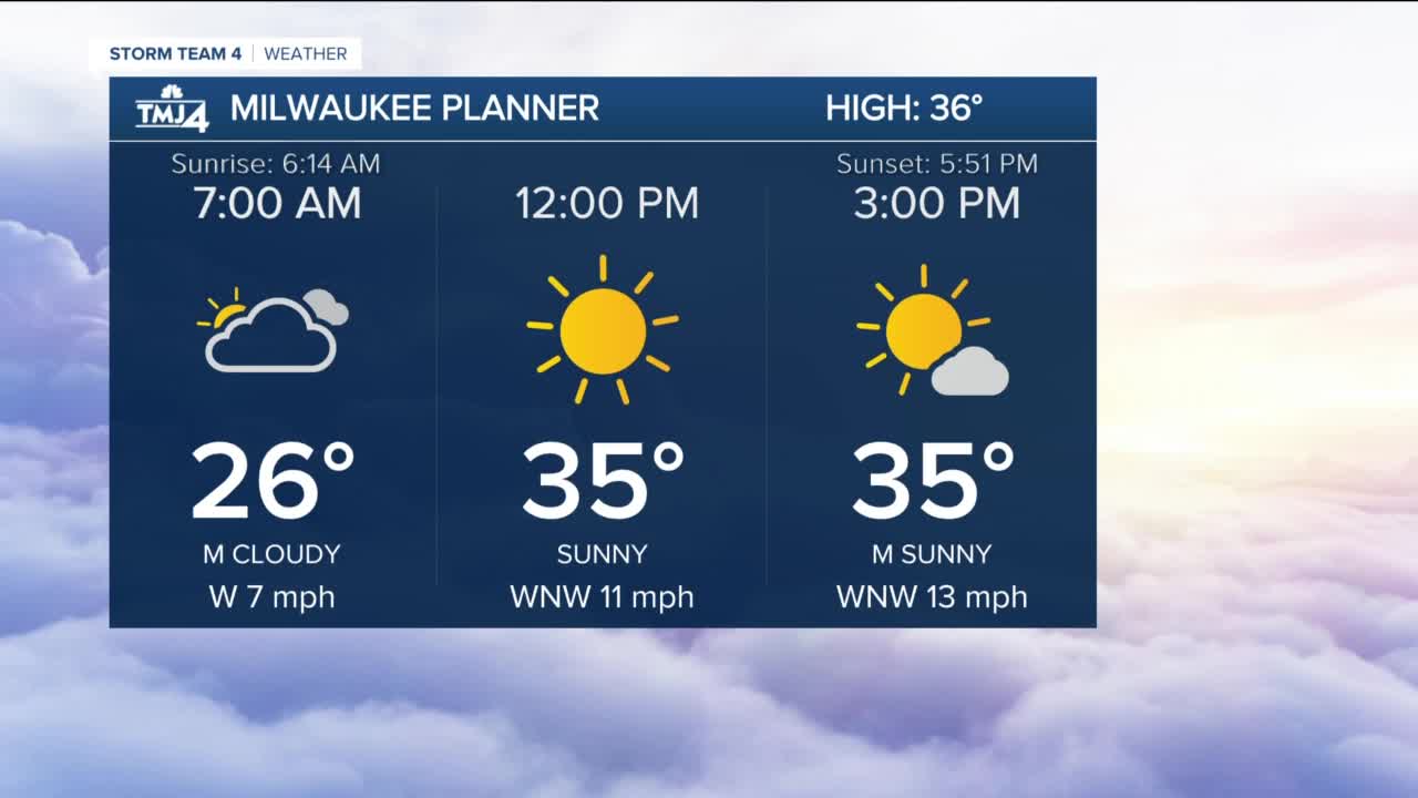
Low: 26 Lakefront...21 Inland
Wind: SW 5-10 mph
WEDNESDAY: Mostly sunny, breezy, and chilly
High: 36
Wind: NW 10-20 mph
THURSDAY: Cloudy with light snow by late afternoon
High: 27
Wind: NW 5-10 mph
FRIDAY: Morning snow ending, then mostly cloudy, chilly and windy
Accumulation: 1-2"
High: 32
Wind: NW 15-25 mph
SATURDAY: Mostly sunny, windy and cold
High: 27
Wind: NW 15-30 mph
SUNDAY: Partly cloudy, windy and warmer with wintry mix by evening
High: 43
Wind: SW 15-25 mph
