

It was another cold morning with lows in the single digits, but the SW wind gusting over 30 mph finally warmed us up into the mid 30s today. The wind remains gusty this evening and tonight with gusts to 25 mph and lows in the lower 20s. Wind chills will be in the teens above zero compared to below zero the past few nights. Saturday is sunny, breezy and mild with highs in the lower 40s with a SW wind to 15 mph.
Sunday is even warmer with highs in the mid to uppers 40s and a SW wind to 15 mph. Clouds start to increase in the afternoon ahead of the next storm that will bring a rain/snow mix by late Monday. Mondays high will be in the upper 30s. Tuesday is snowy with highs in the low to mid 30s, so it will be a heavy, wet snow. Light snow lingers into Wednesday with highs near freezing and a strong NE wind. Colder air settles back in for Thursday and Friday with highs in the 20s.
TONIGHT: Mostly clear, breezy and warmer
Low: 23
Wind: SW 15-25 mph
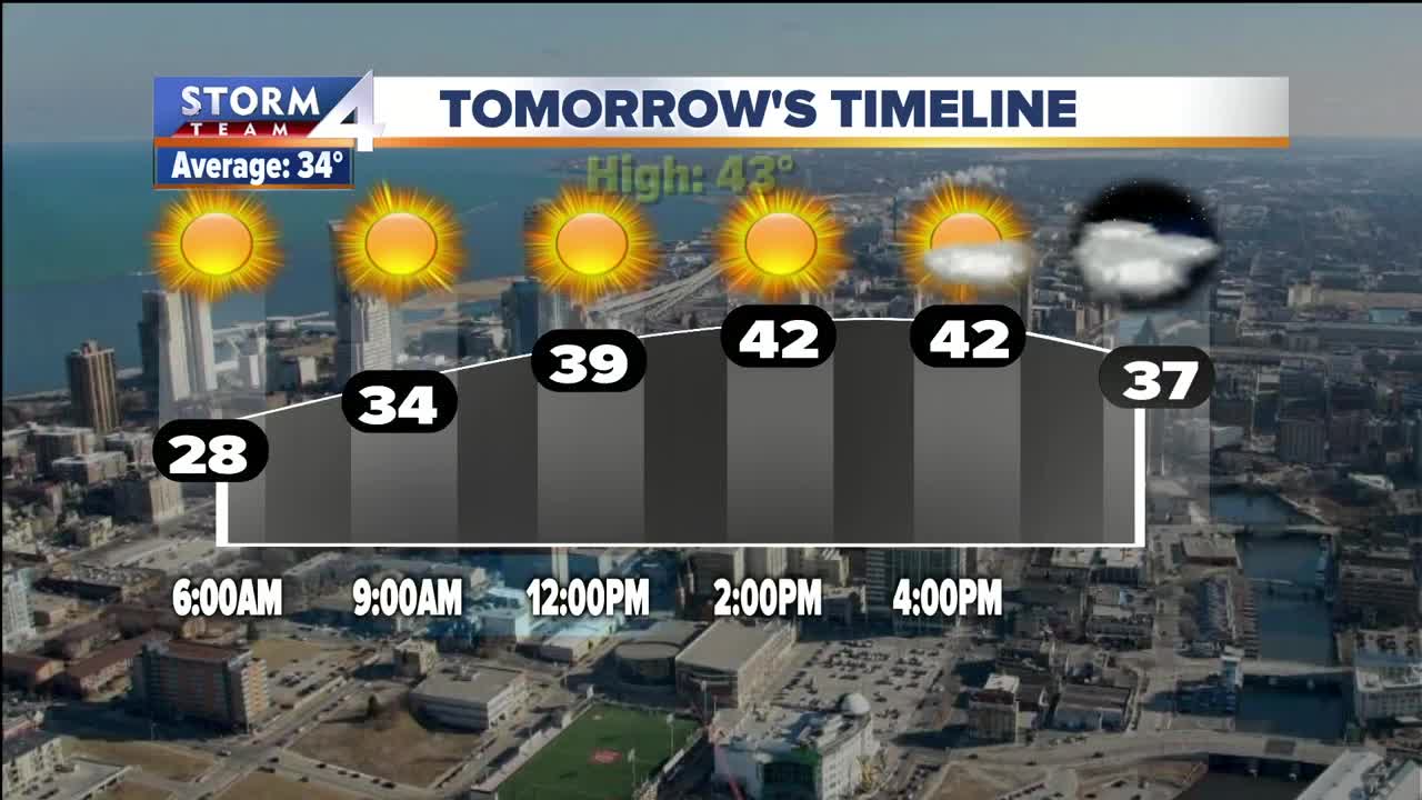
SATURDAY: Mostly sunny, breezy and mild
High: 43
Wind: SW 10-15 mph
SUNDAY: Morning sun then increasing clouds and mild
High: 47
Wind: SW 10-15 mph
MONDAY: Mostly cloudy with a chance for rain/snow by evening
High: 38
Wind: NE 10-15 mph
TUESDAY: Cloudy and breezy with snow likely
High: 35
Wind: NE 10-20 mph
WEDNESDAY: Cloudy and windy with light snow showers
High: 32
Wind: NE 15-25 mph
