
The National Weather Service confirmed four tornadoes touched down in southeastern Wisconsin during the storms on Wednesday.
Survey teams, which were deployed in Wisconsin on Thursday, identified one tornado as an EF-1 and the other three as EF-0 tornadoes, the lowest rating on the Enhanced Fujita scale, with max winds of 70 mph.
11:00a UPDATE -- @NWSMilwaukee has confirmed two tornadoes in Dodge County from yesterday's storms. Both exhibited EF-0 strength with max winds of 70 mph. Two survey teams have been deployed in southern Wisconsin today. pic.twitter.com/ZgJL0zLXrI
— Brendan Johnson (@WxBrendan) July 17, 2025
The first tornado, an EF-1, touched down around 12:24 p.m. Wednesday near the intersection of HWY YZ and HWY Z, northeast of Dodgeville. It ended near Knobs Road, southwest of Hyde. Winds reached 95 MPH.
An EF-0 then touched down near Mazomanie in Dane County around 1:15 p.m. Wednesday near the intersection of Racek Road and WI-78. Max wind speed reached 80 MPH.
Another EF-0 the intersection of County Road E and West Hillcrest Road southwest of Hustisford at approximately 3:20 p.m. With estimated wind speeds of 70 mph, it traveled northeast before dissipating near Grey Road and Wildcat Road around 3:36 p.m.
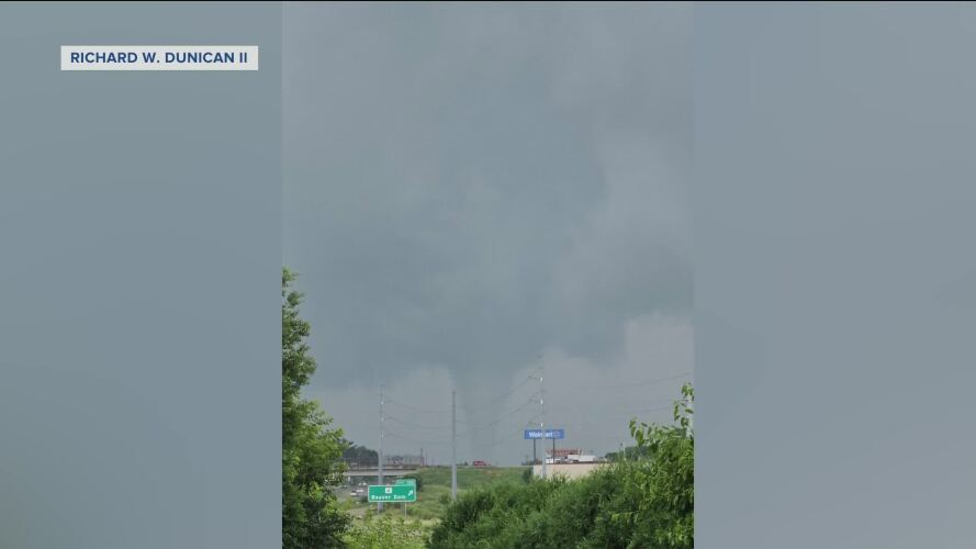
Watch: Two EF-0 tornadoes confirmed in southeastern Wisconsin
A third EF-0 tornado with estimated winds of 65 mph briefly touched down in cornfields and tree lines near Buckhorn Road and Breezy Point Road. This tornado both formed and dissipated around 2:59 p.m.
It’s about time to watch on your time. Stream local news and weather 24/7 by searching for “TMJ4” on your device.
Available for download on Roku, Apple TV, Amazon Fire TV, and more.
